In a world obsessed with connection and shrinking distances, the Diomede Islands stand as a rare testament to how space and time still divide us. They remain one of Earth’s most peculiar and poetic paradoxes—separated not by distance, but by time.
In the frigid waters of the Bering Strait between mainland Alaska and eastern Siberia lies a natural and political curiosity: the Diomede Islands. These two small landmasses—Little Diomede, belonging to the United States, and Big Diomede, claimed by Russia—are separated by a mere 2.4 miles of sea, but they lie on opposite sides of the International Date Line. As a result, they are divided not just by national allegiance but by an entire day.
Though only 2.4 miles apart, the Diomede Islands are worlds away. One is free but isolated; the other is secured but forbidden. Together, they are a powerful reminder that time, politics, and geography can turn neighbors into strangers.
What Are the Diomede Islands?
The Diomede Islands consist of two remote, rocky islands situated in the middle of the Bering Strait, between mainland Alaska and eastern Russia. These islands sit just 2.4 miles (3.8 km) apart, yet they mark one of the starkest contrasts in geography, politics, and timekeeping in the world.
Big Diomede (Russia)
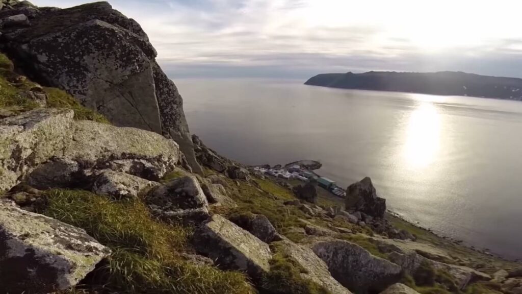
Also called Ratmanov Island, Big Diomede is the easternmost island of the pair and belongs to Russia. This larger island spans roughly 29 square kilometers (11 square miles) and rises steeply out of the ocean, with rugged cliffs and no natural harbors.
The Russian government operates it as a military outpost, primarily used by the Russian Border Guard Service to monitor the maritime boundary between Russia and the United States. Since the end of World War II, authorities have kept the island strictly off-limits to civilians.
In the late 1940s, the Soviet Union forcibly relocated the indigenous Chukchi and Siberian Yupik people who lived on the island to the mainland. Since then, the island has had no permanent civilian population, and visitors must obtain high-level federal clearance from Moscow to set foot on it.
With its high cliffs, extreme Arctic weather, and restricted access, Big Diomede remains a strategic and symbolic frontier—a place where you can see another country, but not set foot on it.
Little Diomede (USA)
Known as Iŋaliq in the Inupiat language, Little Diomede belongs to the United States and is part of the Nome Census Area in Alaska. The island measures about 7.3 square kilometers (2.8 square miles) and features a steep, rocky coastline that makes access difficult in all seasons.
Despite the harsh conditions, around 80 to 100 Inupiat Eskimos live in the small village of Diomede, located on the western shore facing Russia. These residents have preserved their subsistence lifestyle, hunting whales, walruses, and seals, while integrating limited modern amenities like electricity, internet via satellite, and a public school.
There are no roads, cars, or commercial establishments on the island. Residents travel by foot, snowmobile, or helicopter, depending on the season. The U.S. government provides limited support, mainly in the form of seasonal helicopter deliveries for food, fuel, and medical supplies.
Little Diomede serves as a living example of cultural resilience, where traditional indigenous practices continue despite the isolation and lack of infrastructure. The community maintains a strong connection to the land and sea, embodying a way of life that few others experience today.
Time Difference: How the International Date Line Divides the Islands
The International Date Line (IDL) creates one of the most fascinating temporal anomalies on Earth right between Little Diomede and Big Diomede. Although these two islands lie just 2.4 miles (3.8 kilometers) apart, the IDL cuts directly between them, placing them in two different calendar days. This simple yet powerful invisible line produces a 21-hour time difference, separating “yesterday” from “tomorrow”.
Little Diomede (USA): Alaska Standard Time (UTC -9)
The United States places Little Diomede within the Alaska Standard Time Zone, which runs at UTC -9. During daylight saving time, it adjusts to UTC -8, but the time difference with Big Diomede remains dramatic due to Russia’s fixed time policy in that region.
People on Little Diomede live their lives closely tied to natural cycles, yet remain nine hours behind Coordinated Universal Time. They start their week while their Russian neighbors have already lived through nearly an entire day.
From Little Diomede, you can look west across the narrow Bering Strait and quite literally see “tomorrow” happening in real time, making this one of the few places on Earth where time becomes visibly divided.
Big Diomede (Russia): Anadyr Time (UTC +12)
On the Russian side, Big Diomede falls under Anadyr Time, operating at UTC +12. This is one of Russia’s far eastern time zones, reflecting the country’s massive geographic scale. Russia does not observe daylight saving time, so the time difference remains consistent year-round.
When it’s 9:00 AM Monday on Little Diomede, it’s already 6:00 AM Tuesday on Big Diomede. That means the island is 21 hours ahead, though it lies just a short distance to the west. The time gap can be confusing for those unfamiliar with global time zones, but it highlights just how arbitrary and human-defined these time boundaries really are.
Big Diomede effectively serves as the first landmass to greet each new day in this part of the world, further adding to its symbolic value as “Tomorrow Island.”
“Yesterday Island” and “Tomorrow Island”
Because of the time gap, locals and curious observers often refer to the Diomede Islands by these poetic nicknames:
- Little Diomede – “Yesterday Island”
- Big Diomede – “Tomorrow Island”
These names aren’t just figurative—they represent a real, measurable difference in time. If you stood on Little Diomede and communicated with someone on Big Diomede, you’d essentially be talking to someone in the future. This makes the islands a favorite case study in time zone phenomena, used in geography textbooks, documentaries, and travel features around the world.
A Surreal Place Where Time Stands Still—and Moves Ahead
This 21-hour gap over just 2.4 miles makes the Diomede Islands one of the most surreal and mind-bending geographic locations on the planet. Nowhere else can you:
- Witness two countries on opposite sides of the International Date Line,
- Observe two different days at the same time, and
- Experience how invisible borders of time can define reality just as powerfully as physical borders.
The Diomede Islands serve as a living example of how humanity has imposed artificial constructs like time zones onto the natural world—and how those constructs can have profound consequences on culture, communication, and travel.
Historical and Political Significance: From Shared Culture to Cold War Barrier
For thousands of years, indigenous peoples—including the Inupiat, Yupik, and Chukchi—moved freely between the two Diomede Islands. They used these icy waters for seasonal hunting, cultural exchange, and family reunions, with kayaks and dog sleds often crossing the short stretch of sea between the islands.
The Diomede Islands functioned as a unified cultural space, not two opposing outposts. Families lived on both sides, shared similar dialects, and intermarried regularly. Elders on Little Diomede still recall stories of visiting relatives on Big Diomede before political tensions changed everything.
When the Cold War escalated after World War II, the political landscape transformed drastically:
- The Soviet Union forcibly removed all native residents from Big Diomede in the late 1940s, relocating them to Chukotka on the Russian mainland. They did this to reduce cross-border interaction and tighten border security.
- The Soviet military established a strategic outpost on the island, installing radar systems, communication towers, and border patrol stations to monitor activity in the Bering Strait.
- The USSR banned all cross-border travel, severing centuries of cultural continuity between the two islands. Families became permanently divided by ideology, borders, and—most heartbreakingly—by time.
As the divide grew deeper, the world coined the term “Ice Curtain”, referencing the harsh, frozen waters and the new reality that divided two worlds. Much like the Iron Curtain in Europe, this boundary became a symbol of Cold War isolation and suspicion—a rift not just between nations, but between families and cultures.
Even after the Cold War ended, Russia maintained full military control over Big Diomede, keeping it as a strategic monitoring base in the Far East. In contrast, Little Diomede remains a peaceful U.S. island, where residents continue to live according to ancestral traditions while maintaining American citizenship and identity.
Life on Little Diomede: Harsh Climate and Community Resilience
Little Diomede sits in one of the most extreme and remote environments in the United States. With no permanent connection to the mainland, residents live in complete isolation for much of the year. But this small Inupiat community continues to thrive by leaning on traditional knowledge, intergenerational cooperation, and cultural pride.
- Residents don’t use cars or have paved roads. They navigate the steep, rocky island on foot or use snowmobiles and ATVs in winter. The island’s single village, Diomede, clings to the western cliff face and offers breathtaking but rugged scenery.
- Hunting and fishing provide the primary food sources. Families harvest seals, walruses, bowhead whales, and seabirds during seasonal migrations. They also collect mussels, berries, and fish, preserving meat by drying or freezing it naturally.
- The community operates a small public school for K-12 students, a health clinic staffed by rotating nurses or visiting doctors, and a general store stocked with basic necessities—delivered by helicopter or supply barge during summer or via airdrop in winter.
- Residents preserve their culture through drum dances, native crafts, oral storytelling, and subsistence festivals, especially during whale harvests and seasonal celebrations. Elders pass on survival skills and knowledge of the sea to younger generations.
Even though the island faces frequent blizzards, power outages, and supply shortages, the people of Little Diomede have built a life that honors their indigenous identity, adapts to nature’s extremes, and maintains a close-knit community spirit.
Big Diomede: Forbidden Outpost of Russia
Big Diomede offers a stark and haunting contrast to its American neighbor. Once home to native families and cultural rituals, it now stands as a militarized island with no civilian life—a frozen frontier outpost that symbolizes separation more than settlement.
- In the late 1940s, the Soviet government forcibly relocated all indigenous inhabitants, primarily Chukchi and Siberian Yupik people, to the Chukotka Peninsula. They removed homes, destroyed cultural sites, and erased the island’s native presence.
- Since then, Russia has deployed military border guards and continues to operate radar towers, satellite communication systems, and observation posts on the island. These facilities allow Russia to monitor all sea and air traffic entering the Bering Strait.
- The Russian military strictly prohibits any civilian access to the island. Tourists, journalists, and scientists cannot legally visit Big Diomede, even with prior permission. Russia rarely grants exceptions, even for international research collaborations.
- Though Little Diomede residents can see Big Diomede from their windows, they can’t legally visit it. Attempting to cross the border—either by boat or on foot across frozen ice—would mean violating Russian sovereignty, potentially resulting in arrest or international conflict.
Big Diomede’s current role as a closed military installation highlights how Cold War-era tensions continue to shape even the most remote regions of the planet. Unlike Little Diomede, which sustains a human story of survival, Big Diomede represents a strategic asset, a reminder of the past, and a territory frozen in time.
How to Get There: Visiting the Diomede Islands
Traveling to the Diomede Islands, especially Little Diomede (USA), requires thorough preparation, logistical coordination, and a strong sense of adventure. Because of the island’s extreme isolation, no commercial flights, roads, or regular ferries serve the area. Visitors must arrange chartered transportation and obtain local approval in advance.
How to Reach Little Diomede (USA)
Accessing Little Diomede is a challenge, but it’s possible under the right conditions. Here are your primary travel options:
Charter helicopters from Nome, Alaska
This is the most common mode of access, particularly during winter and early spring. Bering Air, a regional airline, occasionally conducts charter flights using helicopters equipped to handle Arctic landings. The 135-mile flight from Nome takes about 1.5 to 2 hours, weather permitting.
Winter (January to March): Temporary Ice Runway
During the coldest months, residents construct a temporary ice runway on the frozen Bering Sea. This makes it possible for small fixed-wing aircraft to land directly on the ice. Pilots must evaluate the ice thickness and weather patterns daily. The runway only functions when conditions are exceptionally stable.
Summer (July to early September): Limited Boat Access
When sea ice melts in midsummer, boats and small watercraft can navigate the narrow Bering Strait. Travel windows are short and unpredictable due to sudden fog, strong currents, and Arctic winds. Most boats launch from Wales or Nome, Alaska, and the journey takes several hours.
Important Travel Advisory
- Must obtain written permission from the Native Village of Diomede Tribal Council to visit the island. They handle local governance and strictly control who may enter their community.
- Since no hotels, restaurants, or guided tours operate on the island, you’ll need to carry all essential supplies, including food, water, fuel, cold-weather gear, and emergency communication tools.
- Expect basic facilities, and prepare to be completely off-grid—cellular signals rarely work, and internet is slow and satellite-based.
- Visits typically require months of advance planning, weather flexibility, and cultural sensitivity toward the local Inupiat way of life.
Best Time to Visit Diomede Islands
Because of the harsh and unpredictable Arctic climate, planning a visit to Little Diomede requires precise timing. Access is heavily dependent on ice conditions, seasonal weather patterns, and transport availability. Each season offers different opportunities, but each comes with its own risks. Here’s a breakdown of what to expect during the year.
Winter (January to March) – Best for Air Access on Ice
Winter is arguably the most reliable time to reach Little Diomede by air, as the Bering Sea freezes solid, allowing the local community to build a temporary ice runway. This makes it possible for small fixed-wing aircraft and cargo planes to land directly near the village—an option not available during other seasons. In addition, helicopter traffic increases as the cold, stable weather patterns make flights more predictable than in other times of the year.
Travelers visiting during this period often experience stunning natural phenomena, including the northern lights (aurora borealis) and traditional Inupiat winter activities like ice hunting and the spring whaling festival. The season comes with harsh conditions. Temperatures routinely fall to -20°C (-4°F) or lower, and wind chills can push the experience into dangerously cold territory. Visitors must wear arctic-grade outerwear, bring emergency supplies, and carry satellite communication tools in case of weather-related delays.
Winter Pros: Most reliable for air access, cultural events, clear Arctic skies.
Winter Cons: Extreme cold, limited daylight hours, health risks.
Summer (July to Early September) – Best for Boat Access
Summer brings a temporary thaw to the Diomede region, with melting sea ice opening up boat access to the island. During this brief window, small boats and landing barges can approach Little Diomede from the Alaskan mainland. While helicopters still operate occasionally, most expeditions prefer water access due to longer daylight hours and relatively milder weather.
This season is also the best time to witness Arctic wildlife in full swing. You’re likely to encounter puffins, walruses, gray whales, and various seabirds along the cliffs and shores. The island experiences near 24-hour daylight, allowing visitors to the terrain and capture breathtaking views of the Bering Strait. That said, weather unpredictability remains a challenge. Dense fog, sudden storms, and strong winds frequently disrupt boat schedules, and the lack of docks means travelers must prepare for rugged, off-the-grid landings.
Summer Pros: Excellent for wildlife viewing, long days, more tolerable temperatures.
Summer Cons: Weather disruptions, no docking infrastructure, rough sea conditions.
Avoid Spring and Late Fall (April to June & Late September to November)
Travel during spring and late fall is highly discouraged due to rapidly changing and hazardous conditions. As sea ice begins to melt in spring or refreezes in the fall, the region enters an unstable phase where neither air nor water routes remain safe or reliable. Aircraft can’t safely land on melting ice, and boats can’t navigate the broken, shifting floes that dominate the coastline.
During these transitional months, the Bering Strait becomes treacherous. Heavy fog blankets the region, ice floes shift unpredictably, and windstorms are common. Most helicopter services are suspended, and boat captains often refuse to travel. Even locals prepare for isolation during these times, stocking up on food, fuel, and medicine, and limiting movement around the island. Any trip planned during these seasons carries a high risk of cancellation and may leave you stranded without support.
Spring/Fall Pros: None practical for travel.
Spring/Fall Cons: Dangerous weather, unreliable access, total isolation risks.
Here, time zones act like walls. You don’t just cross borders—you cross into tomorrow or return to yesterday. Few people ever get to experience this phenomenon in person.
FAQs
1. Where are the Diomede Islands located?
The Diomede Islands sit in the middle of the Bering Strait, which separates mainland Alaska (USA) from Siberia (Russia). The two islands—Little Diomede (U.S.) and Big Diomede (Russia)—are just 2.4 miles (3.8 kilometers) apart but lie on opposite sides of the International Date Line.
2. What makes the Diomede Islands so unique?
The Diomede Islands are unique because they’re extremely close in distance but separated by 21 hours in time due to the International Date Line. This means Big Diomede is nearly one full day ahead of Little Diomede. The islands also represent a geopolitical and cultural divide between Russia and the United States.
3. Can I visit the Diomede Islands as a tourist?
You can visit Little Diomede (USA), but access is very limited and requires advance permission from the Native Village of Diomede Council. There are no hotels, restaurants, or regular transportation, so you’ll need to bring your own supplies and coordinate logistics from Nome, Alaska.
Big Diomede (Russia) is strictly off-limits to civilians and can only be accessed with high-level clearance from the Russian government.
4. Why is there a 21-hour time difference between the two islands?
The International Date Line (IDL) runs between Little Diomede and Big Diomede, placing them in different calendar days. Little Diomede follows Alaska Standard Time (UTC -9), while Big Diomede follows Anadyr Time (UTC +12), resulting in a 21-hour time gap—despite being just a few miles apart.
5. Do people live on the Diomede Islands?
Yes, but only on Little Diomede (USA). A small Inupiat Eskimo community of around 80 to 100 residents lives there year-round. Big Diomede (Russia) has no civilian population and is used exclusively for military operations by the Russian government.
6. How do people get to Little Diomede?
Travel to Little Diomede is possible only by helicopter from Nome, Alaska, or boat during ice-free months (July to early September). In winter, locals build a temporary ice runway on the frozen sea for small aircraft. Travel depends heavily on weather and sea ice conditions, and flights are often delayed or canceled.
7. What is life like on Little Diomede?
Life on Little Diomede is harsh but resilient. Residents rely on subsistence hunting and fishing, navigating the rocky terrain by foot or snowmobile. There is a public school, a general store, and a small clinic. Despite the isolation and extreme weather, the community preserves strong indigenous traditions and cultural identity.
8. What was the “Ice Curtain”?
The “Ice Curtain” refers to the Cold War-era divide between Little and Big Diomede, when the Soviet Union cut off all communication and travel between the islands. The USSR evacuated native residents from Big Diomede in the 1940s and turned it into a military base, ending centuries of shared culture and family ties across the strait.
9. Can you see Russia from the United States at the Diomede Islands?
Yes, you can. On a clear day, residents of Little Diomede (USA) can see Big Diomede (Russia) across the narrow 2.4-mile stretch of water. It’s one of the few places in the world where you can physically see another country—and another day—at the same time.
10. Why are the Diomede Islands called “Yesterday” and “Tomorrow” Islands?
Locals and visitors often refer to Little Diomede as “Yesterday Island” and Big Diomede as “Tomorrow Island” because of the 21-hour time difference created by the International Date Line. From Little Diomede, you’re literally looking into tomorrow when gazing toward Big Diomede.